What Is NOAA?
The National Oceanic and Atmospheric Administration (NOAA) is a scientific agency of the United States federal government that focuses on the conditions of the oceans and the atmosphere. NOAA’s mission is to understand and predict changes in the Earth’s environment and to conserve and manage coastal and marine resources.
NOAA carries out a wide range of weather- and climate-related activities to achieve its mission, including:
- Weather forecasting: NOAA provides weather forecasts and warnings to the public.
- Climate monitoring: NOAA studies long-term patterns of climate and climate change, and provides information to help decision makers plan for a changing climate.
- Ocean observations: NOAA studies the physical, chemical, and biological characteristics of the oceans, and provides information on ocean circulation, tides, and coastal hazards.
- Coastal management: NOAA works to protect and conserve the nation’s coastal and marine resources, including fisheries, wildlife, and habitats.
- Environmental research: NOAA conducts scientific research to better understand the Earth’s environment and the factors that are affecting it, such as pollution, overfishing, and climate change.
- Satellites and data management: NOAA operates a fleet of satellites and provides data management services to support its other activities, as well as the broader scientific community.
Doesn’t NASA do climate research too?
Yes, it does some. In fact, it collaborates with NOAA on several research projects. Unlike NOAA, though, NASA’s mission is to drive advances in science, technology, aeronautics, and space exploration. While NASA also studies the Earth and its environment as part of understanding the only known world with a vibrant variety of life-forms, its focus is more on exploring the universe and understanding our place in it. NASA’s activities include space missions to other planets, the development of new technologies for space exploration, and the study of the Earth from space.
As seen in the above video, NASA will often conduct launches of new NOAA assets. It also collaborates on some orbiting science satellites. Some of the missions that NOAA and NASA have collaborated on include:
Deep Space Climate Observatory (DSCOVR)
This joint mission between NOAA and NASA provides real-time solar wind observations to support space weather forecasting. The Deep Space Climate Observatory (DSCOVR) has made several important contributions to our understanding of the Earth and its environment. Some of the key measurements made by DSCOVR include:
- Real-time solar wind measurements: DSCOVR is positioned at the L1 lagrange point, where it provides real-time measurements of the solar wind, a stream of charged particles from the sun. These measurements are critical for space weather forecasts and for understanding the interactions between the sun and the Earth’s magnetic field.
- Earth’s albedo measurement: DSCOVR measures the Earth’s albedo, which is a measure of how much of the sun’s light is reflected back into space by the Earth’s atmosphere and surface. This information is important for understanding the Earth’s energy balance and how it affects the Earth’s climate.
- Ozone measurements: DSCOVR provides measurements of ozone in the Earth’s stratosphere, which is an important component of the Earth’s atmosphere that helps protect us from harmful ultraviolet radiation from the sun. These measurements help us understand how changes in ozone levels are affecting the Earth’s environment.
- Full-disk images of the Earth: DSCOVR provides full-disk images of the Earth, which show the entire Earth as seen from space in a single image. These images provide a unique perspective on the Earth’s environment and are used for a variety of purposes, including weather forecasting and climate research.
Fun fact: DSCOVR resides farther from Earth than the Moon does. In fact, it once caught this video of the Moon passing between DSCOVR and Earth.
Joint Polar Satellite System (JPSS)
This is a series of polar-orbiting satellites that provide critical data for weather forecasting and climate monitoring. The JPSS program is a collaboration between NOAA and NASA, with NOAA being the lead agency.
Suomi National Polar-Orbiting Partnership (Suomi NPP)
Suomi NPP was the precursor to the JPSS series of satellites and still provides critical data for weather forecasting and climate monitoring. Suomi National Polar-orbiting Partnership (Suomi-NPP) is a Earth observation satellite operated by the National Aeronautics and Space Administration (NASA) and the National Oceanic and Atmospheric Administration (NOAA). Launched in 2011, Suomi-NPP is a joint project between the two agencies, with the goal of providing critical data for weather forecasting and climate monitoring.
Suomi-NPP carries a suite of advanced instruments, including the Visible Infrared Imaging Radiometer Suite (VIIRS), the Cross-track Infrared Sounder (CrIS), and the Advanced Technology Microwave Sounder (ATMS). These instruments allow Suomi-NPP to make highly detailed observations of the Earth’s surface, including measurements of atmospheric temperature and humidity, cloud cover, sea surface temperature, and land and ocean surface temperature.
The data collected by Suomi-NPP is used by weather forecasters to make more accurate weather predictions, and by climate scientists to monitor the changing climate and track long-term trends in global temperature, sea level, and other environmental variables.
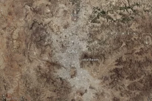
Suomi-NPP data is also used to support disaster response and management, providing critical information to first responders during hurricanes, wildfires, and other natural disasters. As of the time of writing this blog post, data from Suomi-NPP is being used to assist with disaster response in Türkiye and Syria, which have recently been hit hard by earthquakes.
Calibration/Validation missions
NOAA and NASA have collaborated on several missions that are designed to calibrate and validate satellite measurements of the Earth’s environment. These missions include the Clouds and the Earth’s Radiant Energy System (CERES) instrument and the Advanced Microwave Scanning Radiometer (AMSR-E) instrument.
Ocean Biology and Biogeochemistry missions
NOAA and NASA have collaborated on several missions to study the ocean’s biology and biogeochemistry. These missions include the Sea-viewing Wide Field-of-view Sensor (SeaWiFS) and the Ocean Color Instrument (OCI) on the Aqua satellite.
Some ocean biology and biogeochemistry missions that NOAA and NASA have collaborated on include:
Sea-viewing Wide Field-of-view Sensor (SeaWiFS)
This mission was launched in 1997 and was designed to study the distribution and abundance of phytoplankton in the world’s oceans. SeaWiFS provided data that helped to improve our understanding of the role of phytoplankton in the ocean’s ecosystem and in the global carbon cycle.
Ocean Color Instrument (OCI) on the Aqua satellite
The Ocean Color Instrument (OCI) is a scientific instrument on board the Aqua satellite, which was launched in 2002. The OCI is designed to measure the color of the ocean, which provides information about the concentration of various substances in the water, including phytoplankton, dissolved organic matter, and colored dissolved organic matter.
The OCI works by measuring the reflection and absorption of light in the ocean, and the information it provides is used to study a variety of ocean processes and phenomena, including phytoplankton productivity, ocean circulation, and the cycling of carbon and other nutrients in the ocean.
The information provided by the OCI is critical for understanding the ocean’s role in the Earth’s climate and for managing our ocean resources. For example, the information it provides can be used to monitor the health of marine ecosystems, to assess the impacts of human activities on the ocean, and to develop policies and management strategies for ocean resources.
The Ocean Color Instrument is just one of several scientific instruments on board the Aqua satellite, and it works in conjunction with other instruments to provide a comprehensive view of the Earth’s environment, including its atmosphere, land surface, and ocean.
Jason-3 satellite
This is a follow-on mission to the SeaWiFS and OCI missions and was launched in 2016. Jason-3 provides data on sea level, wind speed, and ocean temperature, which is used to study the ocean’s circulation and its role in the Earth’s climate system.
These collaborations between NOAA and NASA contributed an improved understanding of climate change’s impact on the ocean and weather patterns, including:
- Temperature records: NOAA and NASA have provided a long-term record of global temperature and atmospheric carbon dioxide levels, which have shown a clear warming trend over the past century. These records provide a key line of evidence for the reality of human-caused climate change.
- Sea level rise: NOAA and NASA have monitored sea level rise and its impacts on coastal communities and ecosystems. These data have shown that sea levels have risen about 8 inches (21 cm) since 1880 and are projected to continue to rise at an accelerating rate in the future.
- Ocean acidification: NOAA and NASA have monitored the acidity of the ocean and its impacts on marine species and ecosystems. These data have shown that the ocean is becoming more acidic due to the absorption of atmospheric carbon dioxide, which is having major impacts on the ocean’s chemistry and biology.
- Arctic sea ice decline: NOAA and NASA have monitored the extent and thickness of Arctic sea ice, which has shown a rapid decline in recent decades. This decline is having major impacts on Arctic ecosystems and the Earth’s energy budget.
- Extreme weather events: NOAA and NASA have studied the frequency and intensity of extreme weather events, such as hurricanes, droughts, and heat waves. These data have shown that these events are becoming more frequent and intense in many regions due to the warming of the Earth’s atmosphere.
Work NOAA Does on Its Own
Although NASA provides access to valuable resources like access to space and technical expertise for satellites operating on orbit, NOAA operates a few satellites on its own, including (though not limited to):
Geostationary Operational Environmental Satellites (GOES): A constellation of satellites that provides continuous weather observations of the Americas and the surrounding ocean regions.
Polar Operational Environmental Satellites (POES): These satellites orbit the Earth from pole to pole and provide global coverage of the Earth’s weather and environment.
Joint Polar Satellite System (JPSS): This is a series of polar-orbiting satellites that provide critical data for weather forecasting and climate monitoring.
Deep Ocean Assessment and Reporting of Tsunamis (DART): This is a system of ocean buoys that detect tsunamis and provide real-time warnings to coastal communities.
Coastal Zone Color Scanner (CZCS): The Coastal Zone Color Scanner (CZCS) was flown on the Nimbus-7 satellite. Nimbus-7 was a polar-orbiting satellite that was launched by NASA in 1978 and operated until 1986. The CZCS was one of several instruments aboard the Nimbus-7 satellite, and it was designed to measure ocean color and phytoplankton productivity in the coastal zone. The CZCS provided valuable data that helped to advance our understanding of the Earth’s oceans and the role they play in the global environment.
The Coastal Zone Color Scanner (CZCS) made a significant contribution to our understanding of the Earth’s oceans by providing data on ocean color and phytoplankton productivity. This information helped scientists to better understand the complex relationships between the ocean, the atmosphere, and the biosphere.
Phytoplankton are microscopic plants that form the base of the ocean food chain. The CZCS was able to detect changes in the color of the ocean caused by the presence of phytoplankton, which allowed scientists to map their distribution and track changes in their abundance over time. This information helped to improve our understanding of the role that phytoplankton play in the ocean’s ecosystem and in the global carbon cycle.
The CZCS also helped to improve our understanding of the ocean’s physical processes, such as ocean circulation, mixing, and upwelling, by providing information on water color, temperature, and other physical properties. This information is important for understanding the ocean’s role in the Earth’s climate system, as well as for managing and conserving ocean resources.
Overall, the data collected by the CZCS provided valuable information that helped to advance our understanding of the Earth’s oceans and their role in the global environment. Scientists still use data from CZCS to study the oceans and to inform management and policy decisions related to ocean resources.
Scientific Impact of NOAA’s Work
NOAA’s data has been used in many scientific papers across a wide range of disciplines, including climate, weather and atmospheric science, oceanography, “space weather,” and ongoing environmental monitoring. Just with its collaborations with NASA, NOAA’s work has especially improved our understanding of:
- Temperature records: NOAA and NASA have provided a long-term record of global temperature and atmospheric carbon dioxide levels, which have shown a clear warming trend over the past century. These records provide a key line of evidence for the reality of human-caused climate change.
- Sea level rise: NOAA and NASA have monitored sea level rise and its impacts on coastal communities and ecosystems. These data have shown that sea levels have risen about 8 inches (21 cm) since 1880 and are projected to continue to rise at an accelerating rate in the future.
- Ocean acidification: NOAA and NASA have monitored the acidity of the ocean and its impacts on marine species and ecosystems. These data have shown that the ocean is becoming more acidic due to the absorption of atmospheric carbon dioxide, which is having major impacts on the ocean’s chemistry and biology.
- Arctic sea ice decline: NOAA and NASA have monitored the extent and thickness of Arctic sea ice, which has shown a rapid decline in recent decades. This decline is having major impacts on Arctic ecosystems and the Earth’s energy budget.
- Extreme weather events: NOAA and NASA have studied the frequency and intensity of extreme weather events, such as hurricanes, droughts, and heat waves. These data have shown that these events are becoming more frequent and intense in many regions due to the warming of the Earth’s atmosphere.
Many scientific papers on climate change have been published in a variety of peer-reviewed journals using data from NOAA. Here are a few examples of journals that have published papers using NOAA’s data:
- Science: Science is one of the world’s leading scientific journals, and it has published numerous papers on climate change using data from NOAA, including studies on temperature trends, sea level rise, and the impacts of climate change on ecosystems.
- Nature: Nature is another prestigious scientific journal, and it has also published numerous papers on climate change using data from NOAA, including studies on the impacts of climate change on Arctic sea ice and ocean acidification.
- Environmental Research Letters: Environmental Research Letters is a journal that focuses on interdisciplinary research on the environment, and it has published many papers using data from NOAA on topics related to climate change, such as the impacts of climate change on extreme weather events and the carbon cycle.
- Journal of Climate: The Journal of Climate is a leading journal in the field of climate science, and it has published many papers using data from NOAA on topics related to climate change, such as the role of the ocean in regulating the Earth’s climate and the causes of recent temperature trends.
- Geophysical Research Letters: Geophysical Research Letters is a journal that covers a wide range of topics in geophysics, including climate science, and it has published many papers using data from NOAA on topics related to climate change, such as the impacts of climate change on the ocean and the Arctic.
Why does NOAA use satellites for its work?
There are several advantages that make satellites superior to ground-based techniques for monitoring climate and weather. These advantages include:
Global coverage: Satellites provide a unique perspective on the Earth’s climate and weather because they can observe the entire planet, not just specific regions. This is important for tracking weather patterns and for understanding how different parts of the world are affected by weather and climate.
Consistent measurements: Satellites can make consistent and accurate measurements of the Earth’s climate and weather from space, which is important for understanding long-term trends and for detecting changes over time.
Continuous monitoring: Satellites provide continuous monitoring of the Earth’s climate and weather, which is important for understanding how it is changing over time and for detecting unusual events or trends.
Monitoring of multiple variables: Satellites can measure a wide range of variables related to the Earth’s climate and weather, including temperature, precipitation, atmospheric pressure, wind speed and direction, and cloud cover.
Remote sensing: Satellites provide remote sensing capabilities, which allow them to observe the Earth’s climate and weather without being directly in contact with it. This is important for measuring areas that are difficult or impossible to access, such as the Arctic or remote ocean regions.
Complementary to ground-based observations: Satellites can provide valuable information that complements ground-based observations. For example, satellites can provide a global view of the Earth’s climate and weather, while ground-based stations can provide detailed, local observations.
More accurate weather reports: Because satellites can provide detailed information on weather systems over a greater distance than ground-based stations and provide real-time data, they can provide more accurate weather forecasts than previously possible.
One downside is that most local weather stations usually don’t own a geostationary weather satellite that stays over their area. Instead, they typically use data from weather satellites owned by federal government agencies, such as NASA and NOAA, as well as from commercial weather satellite providers. This data is used to create weather forecasts, maps, and animations that are then broadcast on local news stations.
Weather satellites provide critical information about the Earth’s atmosphere and help meteorologists make accurate weather predictions. The data from these satellites is used by a wide range of organizations, including government agencies, private companies, and the media, to provide critical information about the Earth’s climate and weather.
Most importantly, NOAA’s work gives us a more accurate understanding of climate change and its impact on Earth’s oceans. Its satellites can provide advance warning of severe weather events like hurricanes. Some of them can even provide real-time data that assists first responders and rescue personnel working in natural disaster zones like the area impacted by the earthquakes near the border between Teriyaki and Syria.